Advanced Techniques for Creating and Optimizing Seamless PBR Textures from Aerial Photogrammetry
Aerial photogrammetry has emerged as a powerful technique for capturing extensive, high-fidelity surface detail over large geographic areas, enabling the creation of physically based rendering (PBR) textures with an unprecedented degree of realism and scale. Unlike traditional ground-level photogrammetry or hand-crafted texture authoring, aerial photogrammetry leverages drone or aircraft-mounted imaging systems to systematically acquire overlapping photographs from elevated vantage points. This method excels at documenting complex terrain, architectural environments, and natural landscapes with rich spatial context, making it particularly well-suited for applications in games, architectural visualization (archviz), and visual effects (VFX). Understanding how aerial photogrammetry integrates into the PBR texture pipeline is critical for maximizing its benefits while mitigating inherent challenges related to data acquisition, texture synthesis, and real-time rendering optimization.
At its core, aerial photogrammetry involves capturing a dense array of high-resolution images that cover a target area from multiple angles and altitudes. These images are then processed through structure-from-motion (SfM) and multi-view stereo (MVS) algorithms to reconstruct detailed 3D geometry and generate orthomosaic textures. The resultant datasets provide a spatially coherent foundation from which PBR texture maps can be extracted or derived. The orthomosaic imagery often exhibits high color fidelity and spatial resolution, lending itself directly to the creation of albedo maps with minimal color correction or manual painting. Additionally, the reconstructed 3D geometry facilitates the generation of essential PBR maps such as normals, ambient occlusion (AO), height/displacement, and roughness by enabling accurate surface orientation and occlusion calculations.
The relevance of aerial photogrammetry to PBR workflows lies in its ability to produce seamless, large-scale textures that maintain physical plausibility across extended surfaces. In game development, for example, expansive terrains and architectural exteriors benefit from photogrammetry-derived albedo and normal maps that capture authentic material variation and micro-geometry. This authenticity translates into more immersive environments that respond reliably to dynamic lighting within engines like Unreal Engine or Blender’s Eevee and Cycles renderers. The physically based nature of the textures—where albedo, roughness, metallicity, and normal maps collectively define the material response—relies heavily on the precision and consistency of aerial image capture and processing. When executed effectively, aerial photogrammetry textures exhibit natural micro-variation and avoid repetitive tiling artifacts, critical for breaking visual monotony in large-scale scenes.
However, the acquisition phase introduces several technical challenges that must be addressed to ensure the final PBR textures meet production standards. Calibration of the aerial imaging system is paramount; parameters such as lens distortion, sensor alignment, and exposure consistency directly influence the quality of the orthomosaic and subsequent texture maps. Inconsistent lighting conditions during flight—due to changing sunlight angles, cloud cover, or atmospheric haze—can result in color shifts or shadows that complicate texture uniformity. Overlapping images must be captured with sufficient sidelap and endlap (typically 70-80% overlap) to guarantee robust 3D reconstruction and accurate texture baking. Furthermore, terrain variability and reflective surfaces can cause reconstruction artifacts or noise in normal and height maps, necessitating careful data filtering and manual cleanup.
From a texture authoring perspective, aerial photogrammetry outputs require meticulous refinement to translate raw orthomosaic data into optimized PBR maps. The albedo map, derived directly from orthophotos, often needs adjustment to remove shadows, specular highlights, or atmospheric color casts that violate energy conservation principles in PBR workflows. This correction may involve color grading, shadow removal via high-pass filtering, or blending with procedural textures to maintain realism without sacrificing physical accuracy. Roughness maps are rarely captured directly from aerial imagery and generally must be inferred through machine learning techniques, manual painting, or photometric analysis, informed by the material type identified in the scene. Normal and height maps are generated by converting the reconstructed mesh detail into tangent-space normal vectors and displacement information, respectively, requiring high-resolution meshes and precise baking workflows. Ambient occlusion maps can be baked from the reconstructed geometry or approximated via screen-space techniques, serving to enhance contact shadows and surface depth cues.
A critical consideration when utilizing aerial photogrammetry for PBR textures is the seamless tiling of textures across large surfaces. Unlike small-scale photogrammetry scans, aerial datasets often cover areas that exceed typical texture resolution budgets, necessitating the use of texture atlasing, mega-texture streaming, or procedural blending techniques. Introducing micro-variation within tiled textures is essential to prevent obvious repetition patterns; this can be achieved by blending multiple orthomosaic patches, applying noise overlays, or integrating procedural detail maps in conjunction with the photographic base. In engines like Unreal, leveraging virtual texturing and runtime texture streaming efficiently manages memory and performance constraints while preserving visual fidelity. Blender, on the other hand, facilitates iterative texture refinement through its node-based shading system, allowing artists to combine aerial photogrammetry-derived textures with procedural detail and masks to enhance material realism.
Optimization is another pivotal step in the pipeline, where raw photogrammetry data is decimated and compressed without significant loss of visual quality. Texture resolution must be balanced against performance budgets, especially for real-time applications. Downsampling albedo maps while preserving color detail, encoding normal maps in efficient formats (such as BC5 or BC7), and compressing roughness and AO maps using appropriate bit depths are standard practices. Mipmapping strategies should be carefully planned to maintain sharpness at close viewing distances and smooth transitions when distant. Additionally, baking high-frequency detail from geometry into normal or height maps reduces the polygon count of the underlying mesh, facilitating smoother integration into real-time engines without sacrificing surface intricacy.
In summary, aerial photogrammetry represents a transformative approach for generating large-scale, physically based textures that anchor digital environments in authentic, spatially accurate data. Its integration into PBR workflows demands an understanding of multispectral image acquisition principles, geometric reconstruction fidelity, and meticulous texture map authoring. When executed with attention to calibration, lighting consistency, and optimization techniques, aerial photogrammetry enables the creation of seamless, realistic texture sets that elevate the visual quality of games, archviz projects, and VFX sequences alike. Mastery of these methods empowers 3D artists and technical directors to harness the full potential of aerial datasets, bridging the gap between real-world complexity and digitally rendered material authenticity.
Achieving high-fidelity, physically based rendering (PBR) textures from aerial photogrammetry begins with meticulous data capture and preprocessing, as the integrity of these initial stages directly governs the quality and utility of final texture maps. Whether deploying drones or utilizing satellite imagery, the acquisition phase must be approached with rigorous attention to flight planning, sensor calibration, and environmental conditions to secure data that is both geometrically and radiometrically consistent. This foundation enables the extraction of seamless albedo, roughness, normal, ambient occlusion (AO), height, and metallic maps that conform to PBR standards and integrate smoothly into real-time engines like Unreal Engine or authoring suites such as Blender.
Flight planning serves as the first critical stride, demanding a balance between spatial resolution, coverage, and overlap. For drone-based captures, flying at lower altitudes increases ground sample distance (GSD), thereby enhancing texture detail—critical for generating sharp albedo and normal maps that preserve micro-variation. However, this must be weighed against practical constraints such as flight time, battery life, and regulatory compliance. Overlapping images, typically 75-85% frontal and 60-70% lateral overlap, are essential to ensure robust feature matching during photogrammetric reconstruction. Insufficient overlap results in sparse or noisy point clouds that compromise mesh accuracy and texture continuity, leading to artifacts in derived maps. Satellite imagery, while offering extensive coverage, often presents coarser resolution and less control over overlap, necessitating selective acquisition of the highest resolution passes and incorporation of ancillary data like digital elevation models (DEMs) for improved alignment.
Camera settings play a pivotal role in securing radiometrically consistent images. Utilizing drones equipped with high-quality, calibrated RGB sensors capable of capturing in RAW format allows retention of maximum dynamic range and color fidelity. Manually fixing exposure and white balance parameters across the entire flight prevents discrepancies caused by automatic adjustments, which can introduce color shifts detrimental to albedo map uniformity. Ensuring the sensor’s sensor spectral response aligns with the intended PBR workflow reduces the need for complex spectral conversions during texturing. Additionally, maintaining optimal aperture and shutter speed settings reduces motion blur and depth of field artifacts that can degrade texture sharpness. In multispectral or hyperspectral imaging setups, synchronization of sensor capture timing and georeferencing is paramount, as these data streams facilitate advanced material identification and refinement of metallic or roughness properties through spectral analysis.
Lighting conditions during acquisition profoundly influence the quality of texture data. Overcast skies offer diffuse illumination, minimizing harsh shadows and specular highlights that complicate albedo extraction. Shadows, while informative for geometry, can introduce false shading artifacts in texture maps if not properly compensated during preprocessing. When acquiring in variable lighting, capturing images at consistent solar angles within narrow time windows reduces irradiance variation, enabling more reliable color correction and normalization. For projects requiring specular or roughness data derived directly from reflectance variations, controlled lighting setups or multiple directional passes may be employed. However, this is often impractical in aerial contexts, necessitating reliance on photometric calibration and sophisticated post-processing to isolate intrinsic surface properties from lighting effects.
Data management protocols must be robust and systematic, given the potentially vast datasets generated. Accurate tagging of metadata—including GPS coordinates, altitude, timestamp, and sensor calibration parameters—facilitates automatic sorting and georeferencing during photogrammetric processing. Employing lossless compression for RAW files preserves image integrity, preventing degradation that could propagate into texture maps. Early organization into logical directories by flight, sensor, and pass enables efficient batch preprocessing. Additionally, maintaining backup copies and incremental versioning safeguards against data loss or corruption, a critical consideration given the time and cost involved in aerial acquisition.
Preprocessing of raw imagery is indispensable to normalize input data and maximize the fidelity of photogrammetric reconstruction. Initial color correction aims to standardize color profiles across all images, counteracting atmospheric scattering, sensor noise, and illumination changes. Techniques such as radiometric calibration using reference panels or in-scene calibration targets provide ground truth for color balancing, ensuring albedo maps derived later are free from artificial color casts. Global histogram matching or more advanced methods like Retinex-based correction can be applied when reference data are unavailable, though these require careful parameter tuning to avoid amplifying noise. Alignment of images is performed through feature detection and matching algorithms embedded in photogrammetry software but can be enhanced by pre-aligning images using GPS and inertial measurement unit (IMU) data. This georeferencing reduces computational load and improves convergence, resulting in denser, more accurate point clouds and meshes.
Beyond alignment, image sharpening and denoising filters may be judiciously applied to improve feature clarity prior to reconstruction. However, these filters must be conservative to avoid introducing artifacts that compromise normal map derivation or micro-variation fidelity. Calibration of lens distortion parameters is another crucial preprocessing step; uncorrected radial and tangential distortions warp features, causing spatial inconsistencies in texture projection. Calibration is typically conducted via checkerboard patterns or in-flight self-calibration routines, yielding intrinsic parameters that feed into reconstruction algorithms. Proper distortion correction ensures that texture maps can be tiled seamlessly and that UV coordinates adhere closely to the underlying geometry, reducing texture stretching and seams.
In cases where multispectral or LiDAR data are available, integrating these datasets during preprocessing enriches the photogrammetric outputs. Normalized Difference Vegetation Index (NDVI) or other spectral indices can inform the generation of metallic maps by identifying vegetation versus man-made surfaces, while height data enhances displacement or height map accuracy beyond what stereo photogrammetry alone can achieve. Fusion of these datasets requires meticulous spatial and temporal registration, often accomplished through iterative closest point (ICP) algorithms and sensor fusion frameworks.
Ultimately, the capture and preparation phase sets the stage for generating PBR textures that exhibit physical plausibility and visual richness. Well-planned flights and carefully calibrated sensors yield raw data that, after rigorous color correction, alignment, and distortion calibration, provide a robust substrate for extracting albedo maps free of shadow and highlight contamination, roughness maps reflective of true micro-surface scattering, and normals that capture subtle relief. Ambient occlusion derived from dense point clouds or baked from geometry further enhances shading realism. Height maps, refined through multisensor fusion, enable displacement effects that contribute to micro-variation and tactile detail when tiled. Metallic maps, often challenging to infer from RGB alone, benefit from spectral data or carefully annotated training datasets.
When importing these textures into engines like Unreal or authoring environments such as Blender, the fidelity achieved during acquisition and preprocessing translates directly into fewer corrective workflows downstream. Seamless tiling, achieved through consistent lighting and geometric alignment, facilitates efficient material instancing and real-time performance optimization. Moreover, adherence to rigorous preprocessing protocols reduces the need for manual retouching or procedural augmentation, allowing artists and technical directors to focus on creative refinement rather than foundational troubleshooting.
In conclusion, the acquisition and preparation of aerial data for PBR texture extraction demand a holistic approach that balances technical precision with practical constraints. The interplay of flight planning, sensor calibration, lighting management, and data preprocessing defines the ceiling of achievable texture quality. Mastery of these elements unlocks the potential of aerial photogrammetry as a powerful tool for producing seamless, physically accurate textures that elevate digital environments across industries.
The foundation of creating high-fidelity, physically based rendering (PBR) textures from aerial photogrammetry lies in robust photogrammetric processing and precise 3D reconstruction workflows. These workflows translate raw aerial imagery into detailed, textured 3D models that serve as the primary source for extracting authentic material properties vital for PBR texturing. Unlike traditional texture creation methods, aerial photogrammetry offers unparalleled spatial context and real-world surface detail, but capitalizing on its potential demands meticulous handling of image data, calibration, point cloud generation, mesh construction, and texture baking.
At the outset, photogrammetry software ingests a series of overlapping aerial images, typically captured via drones or fixed-wing aircraft equipped with calibrated cameras. The quality of these inputs—including resolution, lens characteristics, exposure consistency, and overlap percentage—directly impacts the accuracy of subsequent geometry and texture outputs. Accurate camera calibration is paramount; intrinsic parameters such as focal length, principal point, lens distortion coefficients, and sensor alignment must be either pre-calibrated or estimated through bundle adjustment algorithms within the software. This calibration ensures that the software can reconstruct the camera positions and orientations with sub-pixel precision, which is essential for generating reliable 3D data.
Following calibration, the software performs feature detection and matching across the image set, identifying keypoints that correspond to the same physical points on the terrain or objects. Sophisticated algorithms like SIFT or SURF are often employed to handle scale and rotation invariance amid the aerial perspective. Once matched, these keypoints enable the generation of a sparse point cloud through triangulation, establishing a preliminary 3D structure of the scene. This sparse point cloud, though low in density, serves as the backbone for camera pose refinement via bundle adjustment, optimizing the reconstruction for minimal reprojection error.
The transition from sparse to dense point clouds involves multi-view stereo (MVS) techniques, where the software estimates depth for every pixel, leveraging photometric consistency across images. The resulting dense point cloud forms an exhaustive spatial representation, capturing minute surface variations essential for accurate normal and height map extraction. This density is critical because PBR workflows depend heavily on surface detail to define roughness and normal maps that influence microfacet reflections and light scattering.
Once the dense point cloud is established, the next phase is mesh creation. The conversion from point cloud to polygonal mesh can be accomplished through various surface reconstruction algorithms such as Poisson reconstruction or Delaunay triangulation. Poisson surface reconstruction, with its ability to handle noisy data and fill holes, is particularly favored in aerial photogrammetry when dealing with complex terrains or urban environments. The generated mesh must balance fidelity with optimization—excessive polygon density inflates computational cost and hinders real-time rendering, while insufficient detail sacrifices the quality of normal and height maps derived later. Decimation and retopology processes may be applied to reduce polygon count while preserving critical geometric features.
Texture baking is integral to converting the photogrammetric data into usable PBR maps. The initial baked texture typically represents the albedo map—the diffuse reflectance of surfaces without shadows, specular highlights, or other lighting artifacts. Achieving a clean albedo extraction from aerial data is challenging due to variable illumination conditions, atmospheric scattering, and shadows cast by terrain or vegetation. To mitigate this, photogrammetry software often integrates radiometric correction and shadow removal algorithms during texture generation. Alternatively, workflows may employ separate lighting-normalization passes or rely on image-based lighting (IBL) captures for subsequent processing in dedicated texture authoring tools.
The albedo map derived from the baked texture serves as the base color input in PBR workflows. However, to fully leverage the physically accurate rendering pipeline, additional texture maps must be extracted or inferred. Normal maps, encoding fine surface detail and microgeometry, are frequently generated by comparing the high-resolution mesh against a simplified low-poly base model or via software tools that analyze the mesh’s vertex normals and curvature. Height maps, capturing geometric displacement at the pixel level, can be derived from the same data and are useful for parallax occlusion mapping or tessellation in real-time engines.
Ambient occlusion (AO) maps quantify the occlusion of ambient light in crevices and folds, enhancing depth perception in the rendered material. In aerial photogrammetry, AO can be baked directly from the high-resolution mesh using software like Blender’s Cycles engine or Unreal Engine’s Lightmass. The fidelity of AO maps depends on the mesh quality and the baking resolution. Accurate AO baking is essential for PBR textures, as it interacts multiplicatively with the albedo to simulate soft shadowing effects without altering the base color.
Roughness and metallic maps present a more intricate challenge. These parameters define the microsurface scattering and reflectivity properties critical for realistic material response to lighting. While aerial photogrammetry provides excellent geometric and color data, direct measurement of roughness and metallicity from imagery is generally not feasible. Instead, these maps are often authored procedurally or inferred using machine learning techniques trained on similar materials. Alternatively, spectral imaging or multi-sensor data may supplement photogrammetry workflows to approximate these parameters. Calibration against ground truth samples or reference materials ensures that the inferred maps maintain physical plausibility and consistency across the texture set.
Aerial photogrammetry textures inherently capture large-scale variations and unique surface features but rarely exhibit seamless tiling characteristics necessary for expansive environments in game engines or simulations. Achieving tiling and introducing micro-variation demands post-processing techniques that blend the original photogrammetric texture with procedural noise or detail maps. Tools such as Substance Designer or Blender’s shader nodes enable the creation of layered materials that retain the authenticity of the aerial data while providing the tiling flexibility required in real-time engines like Unreal Engine or Unity. These hybrid materials maintain the spatial fidelity of the original capture but introduce controlled repetition and variation to avoid visible patterns.
Optimization is a crucial consideration throughout the photogrammetric pipeline. High-resolution textures and dense meshes can quickly overwhelm rendering budgets. Therefore, mipmapping, texture atlasing, and LOD (Level of Detail) strategies must be employed. Baking multiple LODs of normal and AO maps, generating lower-resolution albedo variants, and compressing textures using modern formats such as BC7 or ASTC enable efficient streaming and rendering without sacrificing visual quality. Additionally, mesh optimization tools integrated within photogrammetry suites or external applications like Simplygon facilitate adaptive decimation and mesh instancing.
Integration with rendering engines is the final step in validating the photogrammetric PBR textures. Engines like Unreal Engine offer robust material systems capable of interpreting the full suite of PBR maps and supporting advanced features such as tessellation, parallax occlusion, and dynamic global illumination. Importing textures with correct gamma space (linear for albedo, non-linear for roughness and metallic) and proper channel packing (e.g., metallic and roughness stored in separate channels or combined in packed maps) is essential for accurate rendering. Blender’s Cycles or Eevee engines also provide excellent platforms for previewing and iterating on PBR materials, with native support for baking and shader authoring workflows.
In summary, the photogrammetric processing and 3D reconstruction pipeline underpin the creation of seamless, physically accurate PBR textures from aerial imagery. Success depends on rigorous calibration, precise dense point cloud generation, judicious mesh construction, and meticulous texture baking practices that extract clean albedo and geometric data. Supplementing these outputs with inferred roughness and metallic maps, combined with thoughtful tiling and optimization strategies, yields PBR materials that faithfully represent real-world surfaces while meeting the performance demands of modern rendering engines. Mastery of these techniques empowers 3D artists and technical directors to harness aerial photogrammetry as a powerful tool for producing immersive, photorealistic environments.
FAQ
What is covered in this guide?
This guide explains Advanced Techniques for Creating and Optimizing Seamless PBR Textures from Aerial Photogrammetry with practical notes for seamless PBR materials, texture setup, and production use.
Can I use these texture techniques in Blender, Unreal Engine, and Unity?
Yes. The workflow focuses on standard PBR maps and tileable materials that can be used in Blender, Unreal Engine, Unity, archviz, games, and VFX pipelines.
Where can I find textures for this workflow?
Use the AITextured texture library and the related texture links on this page to find seamless PBR materials and preview them before download.
Related Textures
 Procedural Lime Plaster Wall PBR Texture
 Procedural Stamped Sidewalk Concrete PBR Texture
 Procedural Fine Asphalt Road PBR Texture
 Procedural Pitted Concrete PBR Texture
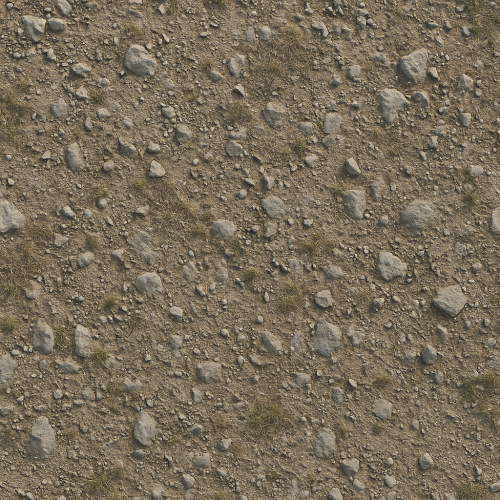
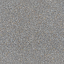 Seamless Concrete Pebble PBR Texture in 4K Resolution
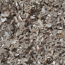 Seamless PBR Concrete Rubble Texture with Debris and Fragments
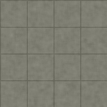
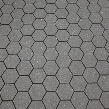 Seamless Hexagonal Concrete Tile PBR Texture 4K
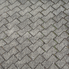 Realistic Concrete Paving Brick Pattern Texture